Edit : Found the object chop and I think bearing measurement is getting it done.
Hi everybody,
Trying to set up a project where there is a central “globe” that has “satellites” around it. The ‘satellites’ are all in fixed cartesian 3D positions that are defined by the latitude and longitude of a city beneath. What I am trying to do next is automate the rotation of these ‘satellites’
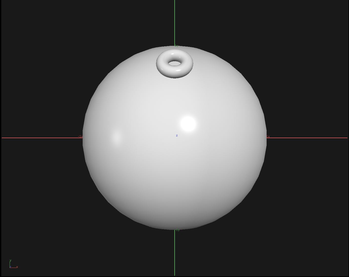
Where I am running into trouble is the rotation of the satellites in relationship to the globe. What I want is all of the ‘Satellites’ 3D geometries to face “out” from the center of the globe. I’ve included a few images to help describe what I am looking to achieve.
I’ve tried a few things but seem to be chasing my tail a bit, some direction or general idea of where to get started would be much appreciated!
Example 1 - No rotation to sphere
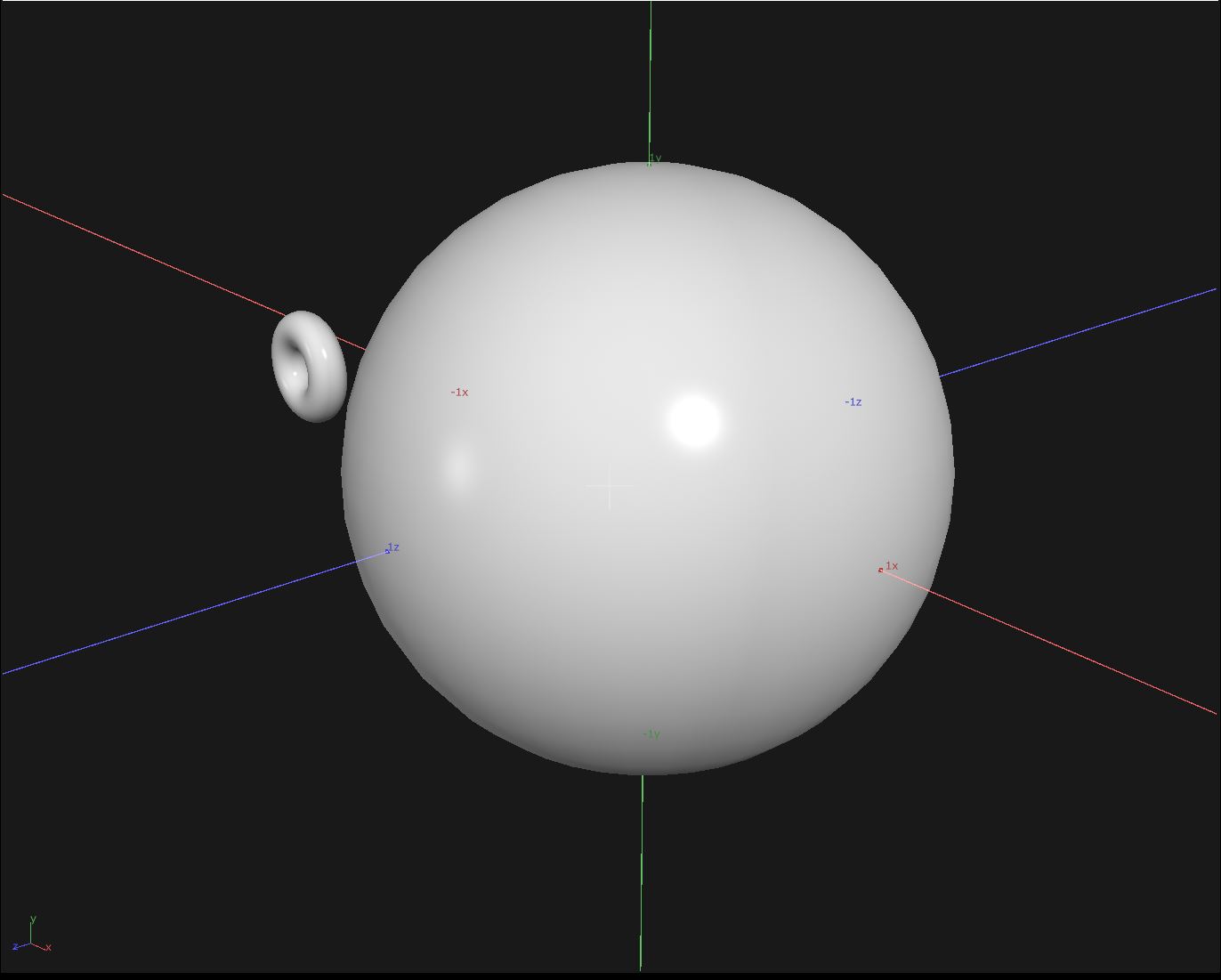

Example 2 : Rotation to spehere